
Trace a Henrico County Street
A useful Henrico County street directory trail follows the address rather than guessing from a name. First normalize the full address with USPS ZIP Code Lookup. Then use the county assessment search to reach the parcel identifier, use the map to understand the parcel, and use the deed route for recorded ownership. A voter-status result or historical directory entry can add a separate, limited resident clue. Neither replaces the other.
- Enter the complete street address in USPS, including the unit when it is known. Keep the returned postal city label with the address, because a Henrico location may also carry a Richmond label.
- Search the Henrico Real Estate Assessment search by street fields. Copy the GPIN or PID shown by the result before moving on.
- Open the same parcel in the Henrico Public GIS Viewer. Check the parcel shape, subdivision or lot context, and nearby polygons instead of assuming every address number marks one residence.
- Use the GPIN, legal description, and party information to reach the Virginia SRA land-record route. The deed instrument is the stronger source for recorded title.
- For a specific person, use the individual Virginia Voter Information Lookup only with its required identity fields. It is not a public street-wide voter tool.
- For an earlier household clue, consult the reverse street sections in greater-Richmond directories. Those sections can connect a street number to a name in a particular year.
Keep the source date and the record type beside each note. Assessment, GIS, deed, voter, and directory data serve different purposes, so a match on one Henrico County street does not turn them into a single current roster.
Henrico County Street Assessment
The assessment portal is the best first stop for a present-day street directory search because its live form is built around parcel and address clues. It does not expose a dedicated owner-name box. Start with the address or GPIN/PID instead of promising a name search that the portal does not offer. Assessment material is not title proof. The county distinguishes its Land Book and CAMA assessment data from the recorded deed record.
| Assessment control | How it helps an address search |
|---|---|
| GPIN | Search or preserve the geographic parcel identifier as a bridge to GIS and related records. |
| PID | Use the parcel identifier when it is available from another record. |
| Street # | Enter the house number from the normalized address. |
| Prefix | Separate directional or other street prefixes where the address uses one. |
| Street Name | Enter the road name without treating an old postal label as a different street. |
| Unit | Add the unit when known; if there is no result, retry without it. |
| Use Code | Narrow a parcel search by the portal's use classification. |
| Description | Use the portal's description field as an additional parcel clue. |
| Sort By | Choose the available result ordering before reviewing matches. |
| Search / Reset | Run the query or clear the form before testing another address form. |
If a future parcel card displays an owner, mailing address, situs address, values, exemptions, sketch, or sales history, record each field separately. The inspected research did not capture a live Henrico parcel-card result, so those display fields should be verified in the live portal rather than assumed.
Henrico County Street GIS Context
The county map is the spatial part of a street directory search. Its RealEstate MapServer includes Tax Parcels, condo boundaries and phases, subdivisions with boundaries and lots, subdivision sections, and appraisal areas. A parcel polygon may be a common area, a vacant tract, or part of a condominium arrangement. That is why a row of map polygons cannot safely be read as a row of households.
Use the viewer's identify or query behavior to inspect the parcel and note the GPIN, subdivision, lot, and map context. The county also offers historic and current imagery swipe, subdivision-plat search, polling maps, and open GIS data through its maps page. The map is a reference source, not a design, construction, flood-zone, or title determination. When a boundary matters, compare it with the recorded legal description and plat.
Henrico County Street Deed Trail
Insider tip: the GPIN or PID is the practical bridge between a Henrico County street address, the map, and the deed trail. After the assessment and GIS checks, search the current owner as a grantee in SRA, find the purchase instrument, then read the seller as grantor and the legal description. Search that seller as a grantee to move backward. An older deed may not index a modern street address at all.
Use the subdivision, lot or block, plat book/page, acreage, and metes-and-bounds clues when the address disappears. The Henrico Circuit Court Clerk keeps the Record Room route for deeds, plats, liens, and copies. SRA may provide index access, while images can depend on an authorized subscription or local agreement. The county's inspected pages did not publish Henrico's online-index start date, so verify the date range with SRA or the clerk.
The Record Room is at 4309 E Parham Road in the Courthouse Building, second floor. Public hours are Monday through Friday, 8:00 a.m. to 4:00 p.m.; land recording ends at 3:30 p.m. Staff do not conduct research by phone. For older deeds, wills, court books, and plats, the Library of Virginia's Henrico microfilm catalog is the documented fallback.
Henrico County Street Records
Each address-keyed source answers a different question along a Henrico County street. Use the parcel number to tie assessment and GIS work together, and use a legal description or instrument number for the recorded land trail. A directory or voter result is supporting evidence with its own limits, not a substitute for a deed.
| Address record | Custodian | Street-level value | Access route |
|---|---|---|---|
| Assessment search | Henrico Real Estate Assessment | Address and parcel identifiers; result-card details require live verification | Online address or GPIN/PID search |
| GIS parcels and layers | Henrico GIS | Parcel geometry, GPIN, subdivisions, condos, and appraisal context | Viewer, MapServer, or GIS data request |
| Deed and plat index | Circuit Court Clerk / SRA | Parties, instrument, date, book/page, and legal description | SRA index, subscriber image route, or Record Room |
| Permit and inspection material | Build Henrico / Building Inspections | Project address and permit or inspection chronology | Online search, monthly data, or records request |
| Voter records | Virginia Elections / Henrico Registrar | Limited public-inspection fields or individual status verification | Statutory inspection and identity-based lookup |
| Reverse directories | VMHC, RPL, HCPL collections | Historical street-number and household clues | Library and historical collection access |
Note: A recorded owner, a tax-mail contact, and a directory occupant can all be different people.
Henrico County Street Permit Evidence
Build Henrico supplies an address-keyed development layer, not a street directory of occupants. Its documented search guide accepts address, date, applicant, and other criteria, including partial entries. The Details, Processes, and Referrals tabs can help place construction, review, or inspection activity on a property timeline. Online permitting applies to submissions after August 30, 2021; the research did not establish a complete earlier online index.
See the Build Henrico search guide for the documented search and result-tab workflow.
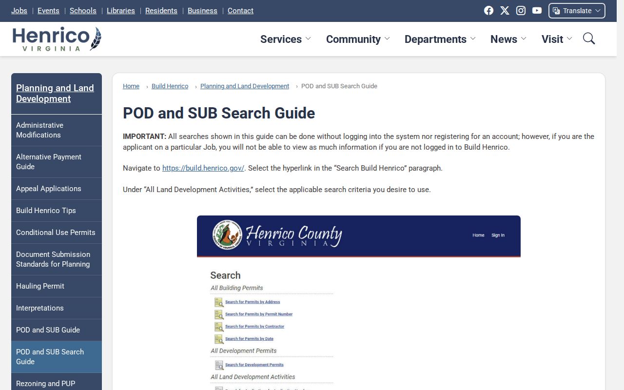
The guide's address, detail, process, and referral path helps date a property event without turning an applicant or project name into a current-resident claim.
For plans, certificates of occupancy, inspection reports, construction dates, and open-permit material, use the Henrico Building Inspections records request. The current form asks for property details and lets a requester specify the record type. The county says it responds within five business days or issues a fee notice. Residential plans are available only ten years after construction.
The building-record request page shows the property and record-choice fields used for that offline fallback.
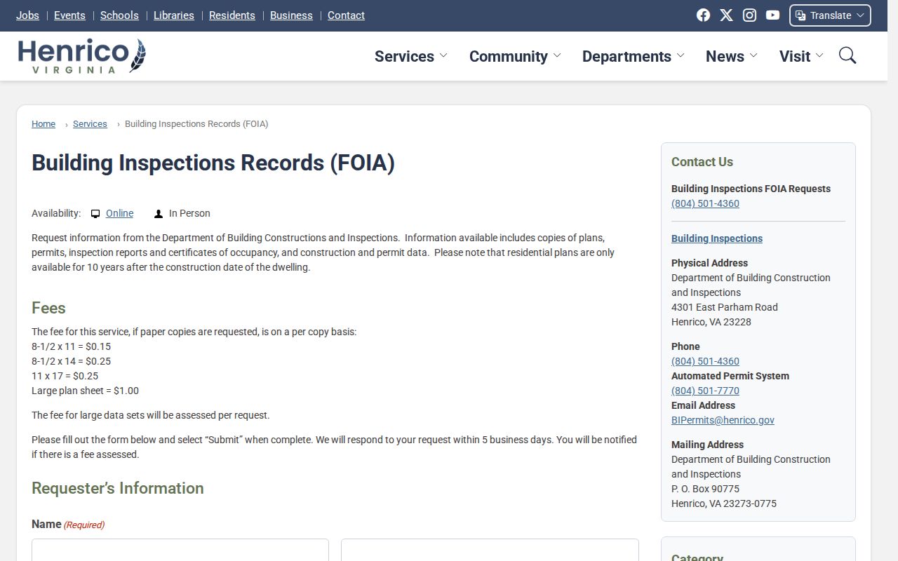
Use a permit or inspection as a dated property milestone. It does not establish title or identify everyone who may have lived at the address.
Henrico County Street Voter Limits
Virginia law permits public inspection of limited voter-list fields, including name, residence address subject to the P.O. box rule, year of birth, gender, and election districts. Social Security numbers, day and month of birth, protected actual addresses, and other excluded data are not public. The state status tool requires a name, date of birth, last four digits of Social Security number, locality, and certification. Its results may provide status, polling place, election district, absentee-ballot status, and voting history, but never ballot choices.
That makes the Voter Information Lookup an individual verification route, not a way to search all people along a street. Bulk voter lists are limited by Va. Code §24.2-405 to specified statutory recipients. For public-inspection or correction questions, use the Henrico Registrar. A no-result can reflect spelling or locality issues and does not prove that a person never registered.
Henrico County Reverse Street Directories
For a past address, the historical street directory layer is the reverse or criss-cross section, arranged by street and number rather than by surname. The Virginia Museum of History & Culture and the Richmond Public Library hold greater-Richmond runs that can be useful for Henrico research. The verified street-address sections begin in 1879/80, while earlier entries can use descriptive locations instead of house numbers.
Search the year before and after the target date. Initials, spouse notations, widow markers, abbreviations, and a move can explain why a name shifts or disappears. Search both Richmond and Henrico labels when the collection is organized around greater Richmond. The collection details are available through the Virginia Museum property-research guide; the historical shelf is covered more fully in the Henrico County city directories.
- Parcel
- A mapped tax piece identified by a GPIN or PID. It can be a residence, common area, vacant tract, or another land unit.
- Situs address
- The physical location attached to a parcel. It is different from the address where tax mail is sent.
- Plat
- A recorded map that can tie a subdivision, lot, block, or boundary to the legal description used in land records.
- Criss-cross directory
- A historical directory section organized by street and number, useful for connecting an address to a dated household clue.
Henrico County Street Postal Labels
The known county address quirk is postal, not a street renumbering. In 2008, USPS changed preferred community names for listed Henrico ZIP codes while retaining Richmond as an alternate for some of them. ZIPs and delivery routes did not change, and no formal address change was required. A Richmond label in an older directory and a Henrico label in a current mailing address may therefore point to the same physical area.
No verified countywide chronology of street renumbering or renaming was located. When a historic address fails, try its ZIP-normalized community label, an omitted unit, a nearby number, the subdivision name, former road clues, and the legal description. Then use GIS and parcel jurisdiction, rather than a postal label alone, to resolve the county question.
Limits of Henrico County Street Directory
A street directory can support a careful property or family-history trail, but it cannot prove that every person at an address is visible or current. Assessment data identifies an assessment record, not title. A different tax mailing and situs address can reflect a business, trust, former address, or maintenance lag. A deed establishes recorded title, not occupancy. A historical directory records a dated clue, not continuous residence.
Virginia's Address Confidentiality Program gives qualifying participants a designated address and makes identifying records exempt from FOIA except in limited circumstances. Public voter records also exclude protected actual addresses. Stop when a source is protected, and do not try to connect it through other records. A precise Virginia FOIA request can seek an existing nonexempt record by address, GPIN, date range, permit number, or record type; it does not require an agency to create a street-by-street database.
Lawful use. Use Henrico County address records for lawful personal, family-history, civic, or property research. Virginia law prohibits stalking, intimidation, harassment, and publishing a person's identifying residence information with intent to coerce or harass.